Showing posts with label VC55. Show all posts

Saturday, 5 January 2019

Tetrad Coverage - Square Bashing for Springtails

My plan for 2019 is fairly simple, to get more organized about tetrad coverage. The tetrad (a 2x2 kilometre square based on the National Grid) is the standard unit for biological recording. One of my problems at the moment is that I don't have any software which is well suited to tetrad recording. However, using the NatureSpot Explore All Records tool which I'm currently basing the Atlas on, I can generate approximate tetrad records (with quite a bit of faffing about).

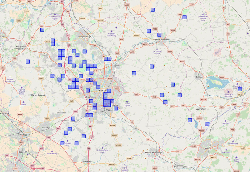
VC55 All Collembola records:
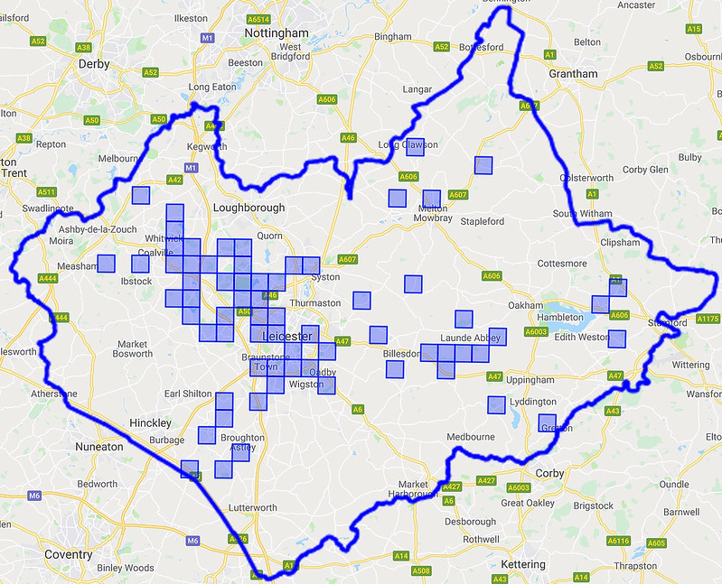
VC55 Collembola Tetrads

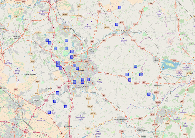
While the pattern of recording generally follows that for other taxons in VC55, what this current map reveals is that there are plenty of gaps to be filled. So far, so simple - drive almost anywhere and record springtails! The next step is a little more complicated - comparing VC55 Collembola records with other taxons. I have decided to adopt two benchmarks for this. The first is a comparison of springtail and woodlice records. I chose to use woodlice because while they are not too far away from springtails, they are more familiar to most people and the common species generate more records than springtails. Thus woodlice represent the next step up the recording hierarchy:
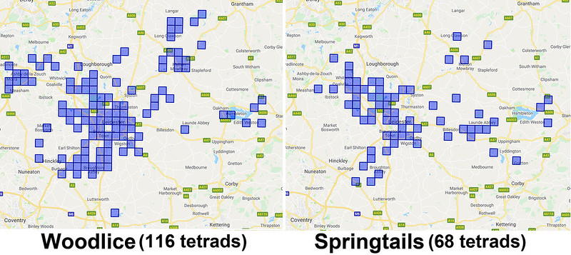
Woodlice vs Springtails

I'm moderately encouraged by this. As expected there are rather more woodlice records in VC55 but this clearly represents an achievable target. The second stage of benchmarking involes correcting for recording effort. Peter Shaw makes a strong case for adopting Orchesella cincta as a benchmark for recording effort/bias:

"... the genus Orchesella is taxonomically uncomplicated and species may be determined by eye using colour patterns. Distribution data for Orchesella species in the UK should therefore be reliable. The commonest and most distinctive is Orchesella cincta (Linnaeus, 1758), with 230 UK records of this species dating back to 1834 (Templeton 1835). The UK distribution map shows a strong bias towards the London area, with very few records in Cornwall, Wales or northern Scotland. Since the rst author of the present review has collected this species with approximately equal ease in all parts of England, Wales and the Scottish lowlands, this distributional bias in fact surely refects recorder bias, though its apparent absence from high mountains may be accurate, as it is said to be replaced by Orchesella alticola. In summary, the main infuence visible on the biogeography of this common, large and distinctive species in the UK is recorder bias. For less common or distinctive species this bias can only be worse."
Shaw, P., et al (2013) Updating taxonomic biogeography in the light of new methods–examples from Collembola. Soil Organisms, 85(3), 161-170.

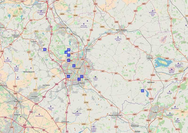
VC55 Orchesella cincta records:
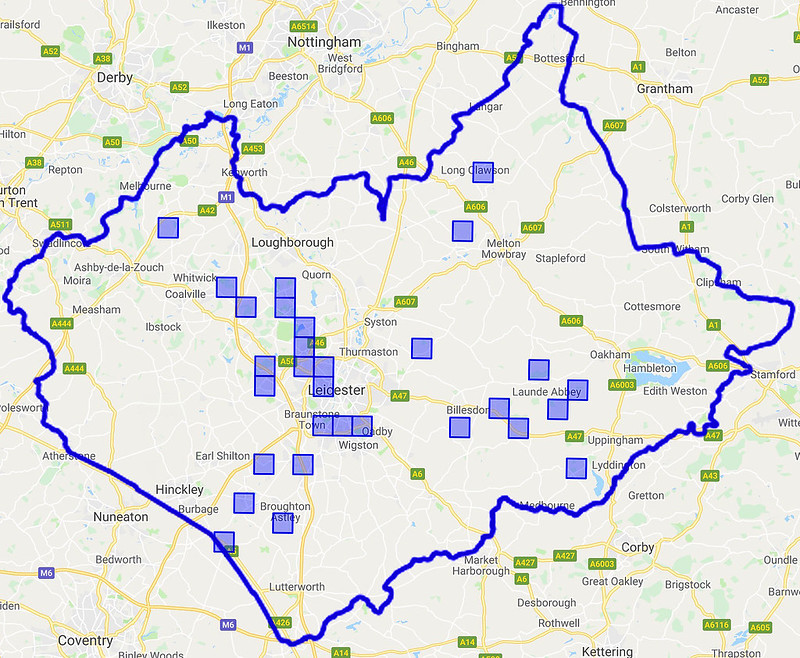
VC55 Orchesella cincta records

To date there are 29 tetrads with Orchesella cincta records, indicating the distance left to travel. It's not clear to me what represents an "acceptable" level of coverage, but these indicators at least allow measurement of progress.

Tuesday, 26 June 2018

Towards a VC55 Springtail Atlas

A few other counties (Shropshire, Lancashire) have ambitious and well-advanced plans to build county atlases of springtails. There are presently no such plans for VC55 (Leicestershire and Rutland), but we do have a secret weapon that the other counties do not have - NatureSpot! In thinking about building a species atlas, there are a few problems which occur to me:

Tools
While there are good free mapping tools available, they require skills which I do not have and realistically will not be able to develop. However, the NatureSpot Explore All Records page provides a simple way of generating maps based on the NatureSpot (=iRecord) dataset, and this is what I have used to derive the maps below. There are a few problems with the Explore tool as it is presently configured, e.g. you can't drill down to individual records by clicking on the map (although all the individual records are listed, with submission evidence, e.g. photos). [UPDATE: my mistake, the NatureSpot maps are clickable - click on the "?" icon then on the square to see the record.] However, it seems to me that this is a viable way to generate an atlas. The only viable alternative that I can see would be the NBN Atlas maps (which are clickable). The NBN maps include a much bigger dataset than NatureSpot, including all the records from the former Collembola Recording Scheme (approximately 10,000 records covering Great Britain and Ireland for 359 species, collected between 1808-2008). However, having read what Steve Hopkin had to say about the accuracy of this dataset, I'm inclined to stick with the contemporary NatureSpot records. It costs a significant amount of money to keep NatureSpot (a registered charity) online and to develop features such as the Explore All Records page. Please make a small donation to keep us going: http://www.naturespot.org.uk/support_naturespot

Coverage
I have two major problems with coverage - geographical and species groups. For a single private individual, VC55 is a pretty big patch, and without more boots on the ground it is not going to be possible to get systematic coverage of the whole vice county throughout the seasons. Springtails are likely to remain Cinderella species and I can't imagine that I would ever be able to attract the public engagement that the Hoverfly Recording Scheme or Butterfly Conservation have done. I'm not sure what can be done about this problem. Another problem is my ignorance of the Poduromorpha, something I need to work on. Cute and photogenic though the globbies may be, I can't ever pretend to have generated a representative atlas without better taxonomic coverage.

Phenology (cyclic and seasonal natural phenomena in relation to climate)
It is only in recent months that I have become aware of the significance of phenology to Collembola, and this just multiples the geographic coverage problem. (Another thing the NBN maps have going for them are the nice phenology charts.)

BUT - having thought about the downsides, what do we have?


VC55 Springtail Atlas (all species, June 2018):
VC55 Springtail Atlas
This isn't as bad as it seems, the coverage reflects the overall pattern of recording in VC55, discussed here.


Single species, e.g. Orchesella cincta:
Orchesella cincta


Single genus: Deuterosminthurus spp:
Deuterosminthurus


Although they are not clickable, the maps are zoomable to get detailed coverage, e.g. Deuterosminthurus species:
Deuterosminthurus zoom


DISCLOSURE:
I am a trustee of NatureSpot, registered charity 1138852.

Acknowledgements:
My gratitude to the hard working NatureSpot team and our developer John Van Breda for making it possible for me to even consider this.