Tools
While there are good free mapping tools available, they require skills which I do not have and realistically will not be able to develop. However, the NatureSpot Explore All Records page provides a simple way of generating maps based on the NatureSpot (=iRecord) dataset, and this is what I have used to derive the maps below. There are a few problems with the Explore tool as it is presently configured, e.g. you can't drill down to individual records by clicking on the map (although all the individual records are listed, with submission evidence, e.g. photos). [UPDATE: my mistake, the NatureSpot maps are clickable - click on the "?" icon then on the square to see the record.] However, it seems to me that this is a viable way to generate an atlas. The only viable alternative that I can see would be the NBN Atlas maps (which are clickable). The NBN maps include a much bigger dataset than NatureSpot, including all the records from the former Collembola Recording Scheme (approximately 10,000 records covering Great Britain and Ireland for 359 species, collected between 1808-2008). However, having read what Steve Hopkin had to say about the accuracy of this dataset, I'm inclined to stick with the contemporary NatureSpot records. It costs a significant amount of money to keep NatureSpot (a registered charity) online and to develop features such as the Explore All Records page. Please make a small donation to keep us going: http://www.naturespot.org.uk/support_naturespot
Coverage
I have two major problems with coverage - geographical and species groups. For a single private individual, VC55 is a pretty big patch, and without more boots on the ground it is not going to be possible to get systematic coverage of the whole vice county throughout the seasons. Springtails are likely to remain Cinderella species and I can't imagine that I would ever be able to attract the public engagement that the Hoverfly Recording Scheme or Butterfly Conservation have done. I'm not sure what can be done about this problem. Another problem is my ignorance of the Poduromorpha, something I need to work on. Cute and photogenic though the globbies may be, I can't ever pretend to have generated a representative atlas without better taxonomic coverage.
Phenology (cyclic and seasonal natural phenomena in relation to climate)
It is only in recent months that I have become aware of the significance of phenology to Collembola, and this just multiples the geographic coverage problem. (Another thing the NBN maps have going for them are the nice phenology charts.)
BUT - having thought about the downsides, what do we have?
VC55 Springtail Atlas (all species, June 2018):
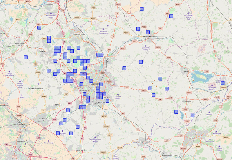
This isn't as bad as it seems, the coverage reflects the overall pattern of recording in VC55, discussed here.
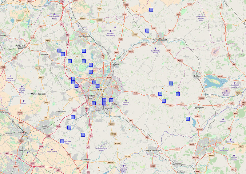
Single species, e.g. Orchesella cincta:
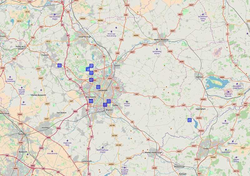
Single genus: Deuterosminthurus spp:
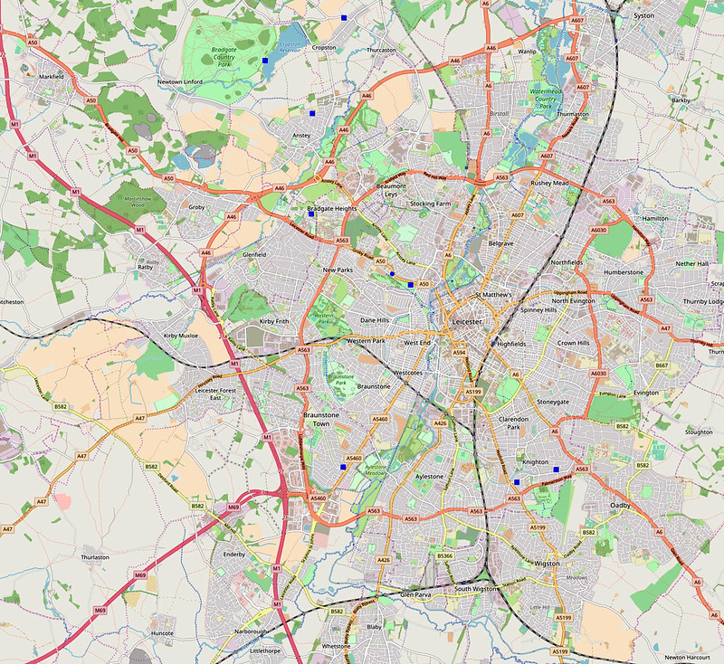
Although they are not clickable, the maps are zoomable to get detailed coverage, e.g. Deuterosminthurus species:
DISCLOSURE:
I am a trustee of NatureSpot, registered charity 1138852.
Acknowledgements:
My gratitude to the hard working NatureSpot team and our developer John Van Breda for making it possible for me to even consider this.
Alan, Can I ask what time period teh records shown on teh maps represent (1 year or much more) ??
ReplyDeleteSteve
Sorry for the delay in replying - 25.04.08-28.06.18, 10 years.
Delete